X
SPECIAL OFFERS

10% discount for travellers opting for Farm Stays


X
TRIP ADVISOR
san-francisco-goldenferry-building-port

Highlander Trek (Laya-Gasa) | 17D

17 Days
Category:

Description

TREK INFO Duration: 17 days
Trek Duration: 12 days
Max Elevation: 5005m
Difficulty: Medium - Hard
Season: April - June and September - November
Start: Sharna Zampa
Finish: Gasa
Access Towns: Paro and Punakha
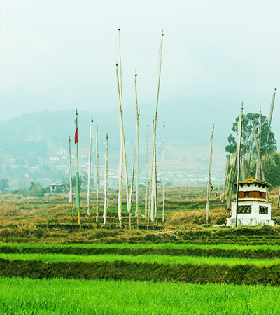
SUMMARY This trek takes you into remote and isolated high country, introducing you to the unusual culture of layap community and allowing you to cross path with Takins (Bhutan’s national animal). If you are lucky you might spot the exotic Blue Poppy, Bhutan’s national flower. The trek begins in the Paro valley and follows the same route as the Jhomolhari trek as far as Lingzhi, before heading north into the highlands. Snow can sometimes close the high passes, but they are generally open from April - June and mid-September to mid-November.
TREKKING PACKAGE INCLUSION
Accommodation/your night Camps.
Good Quality tents with quality sleeping bag, and insulated mat.
Tents (Sleeping tent, Dining tent, Kitchen tent, Toilet tent, Shower tent )
All Trekking Meal during the Trek
One Trekking Expeditions Leader/Expert Trekking Guide
Trekking Chef and helpers (Depending on group size)
Group Medical Kit
All Park entrance Fees and Trekking Permits
Horses and a potter to carry 20 Kgs personal equipments
PACKAGE INCLUSION
Accommodations (3* Hotels and Resorts)
Transportations (Dedicated SUV vehicles with driver)
All 3 meals
Drinking Water (Packaged bottled water)
English Speaking Guide throughout the trip
Monumental fees
Bhutan Tourism Development fee
Visa Processing Fee
PACKAGE DOES NOT INCLUDE
Internation Airfare
Refrehsments, bottled drinks and alcohal
Tips/Gratitudes
Cost arising out of flight cancellation and events beyond our control
Expenses of personal nature
CHECK FOR ESSENTIALS
DURING TREK
  • Clothes: Waterproof jacket and pants, warm clothes at camp sites
  • Bag pack with rain cover
  • Water bottles (2-3 Liters)
  • Sun Hat (During the day hikes)
  • Hiking poles (If necessary)
  • Sunglasses
  • Water-proof Trekking shoes
  • Winter Hat and Gloves
  • AT CAMP SITE
  • Head lamp with extra batteries
  • A pair of Camp shoes too
  • Thermal Inners
  • Reading materials
  • Journal and pens
  • Itinerary

    [Day 1]

    PARO INTERNATIONAL AIRPORT – Your first glimpse of Bhutan


    • On arrival at the Paro International Airport you will be welcomed by your tour guide and driver. After checking into your hotel, visit the impressive Rinpung Dzong/fortress of Heaped Jewels, a fine example of the ostentatious Bhutanese art and architecture. Located above the Dzong is the National Museum showcasing various artifacts and relics of ancient Bhutan.
    • In the evening visit a traditional farmhouse replete with paddy fields, vegetable garden and farm animals. Enjoy a hot stone bath in a wooden tub, get some cooking tips and help in preparing your dinner which you will eat in the traditional Bhutanese style with the whole family.

    [Day 2]

    TAKTSANG MONASTERY/TIGER’S NEST/ Acclimatizing Hike– The high light of your holiday to Bhutan


    • Your highlight of the tour and a day excursion to one of the most petrified sites in Bhutan, Taktsang Monastery / Tiger’s Nest which is about 3 hours uphill and 2 hours down. It is located around 900 meters above the Paro valley. In the 8th Century Guru Padmasambhava – the patron saint of Buddhism established the most sacred place in Bhutan and meditated with his consort Khandro Yeshey Tshogyal. It is believed that Guru flew on a female tigress in pursuit of a demon which he subdued at the current site of the Monastery.
    • You can have your lunch, tea/snacks at the cafeteria midway.
    • Before you drive back to your hotel visit the Kyichu Lhakhang/temple, one of the oldest temples built in the 7th Century by the Tibetan King Songsten Gyembo.
    If you wish you can go for a stroll through the valley or rest in hotel.

    [Day 3]

    SHARNA ZAMPA - THANGTHANGKHA


    Walking Distance: 22 km, 7-8 hours, 770 m ascent, 10 m descent, camp altitude 3,610 m.
    After you breakfast you will drive about 1-2hrs to your starting point of your trek.
    • Brace yourself for a long, hard day with lots of ups and downs, made worse by all the rock-hopping required to avoid mud holes. Begin the day by climbing through conifers and rhododendrons flanking the Paro chhu. You might have to scramble over small hills to get around the river in places. Your campsite will be at thangthangka(3,610m),with a small stone shelter and a Bhutanese-style house in a cedar grove at the edge of the meadow.

    [Day 4]

    THANGTHANGKHA – JANGOTHANG


    Walking Distance: 19 km, 5-6 hours, 480 m ascent, camp altitude 4,080 m.
    • If you did not see Mount Jomolhari the previous evening, you will get a great view in the morning. The trek continues up the Paro Chhu river valley which widens into patches of alpine meadow and scanty growths of forest. Cross an army outpost along the way and enjoy a spectacular view of high mountain ridges and snow-capped peaks. Yaks and the herder’s homes become a regular feature of the landscape. Passing the beautiful villages Soe, Takethang and Dangochang is another highlight of today. Reaching Jangothang, one of the most beautiful campsites of the Himalayas, you will again have a spectacular view of Mount Jomolhari.

    [Day 5]

    ACCLIMATIZATION (HALT)


    Camp Altitude: 4,080 m
    • Jangothang is a perfect environment for your acclimatization. There are plenty of possibilities for day hikes with great views on lakes and snow capped mountains such as Jomolhari and Jichu Drake. Jichu Drake is also one of those unclimbed mountains. There are good chances to spot some blue sheep on the upper slopes of the valley. There are good short hiking trails in three directions. Jumolhari and its subsidiary mountain chains lies directly west, Jichu Drake to the north and a number of unclimbed peaks to the east. Nearby there are trout filled lakes. You may also walk towards the glaciers of Jhomolhari or visit and experience a high altitude village life nearby. Don’t sweat it too much as you prepare yourself for a tough climb the next day.

    [Day 6]

    JANGOTHANG – LINGSHI


    Walking Distance: 18km, 6-7 hours, 840m ascent, 870m descent, Camp Altitude: 4,010 m
    • The trail climbs rapidly for about half an hour and then becomes a gradual ascend to the Nyilila pass at 4,870m. Apart from the beautiful landscape you might see herds of blue sheep grazing on the slopes of the mountains and spectacular views of Mt. Jomolhari, Jichu Drake and Tsherimgang. You will pass through yak herder’s tents made from yak wool. You will also get a view from the top of beautiful Lingzhi Dzong.

    [Day 7]

    LINGSHI – CHEBISA


    Walking Distance: 10km, 5-6 hours,280m ascent,410m descent, Camp Altitude: 3,880 m
    • • Today is the shortest walking day, and you can really take it easy. Shortly after starting you will reach a chorten below Lingshi Dzong. Here, you have the choice of staying on the main trail or taking a diversion up to the Lingshi Dzong (4,220m), which sits right atop a ridge. Besides a very special atmosphere of mystic silence Lingshi Dzong provides a great view over the valley. After Lingshi Dzong you will be passing the villages of Lingshi and Goyul. In Goyul, the stone houses are clustered together to a small compact village that is unusual in Bhutan where village houses are normally scattered. On reaching the campsite at Chebisa with a beautiful waterfall behind the village, you will have plenty of time to visit the village houses if you feel up to it.

    [Day 8]

    CHEBISA – SHOMUTHANG


    Walking Distance: 17km, 6-7 hours, 890m ascent, 540m descent, Camp Altitude: 4,220 m
    • You walk through a wide pastureland towards Gobu La (pass).
    • On the way, you will see a few people herding yaks. There is also a great chance to spot large herds of blue sheep above the trail. After crossing the Gobu La (4,410m), you descend to the valley, then climb again a little bit, and descend again to Shakshepasa (3,980) where a helipad has been established. Climbing from here you will finally reach the campsite at Shomuthang, above a stream which is a tributary of the Pochu River.

    [Day 9]

    SHOMUTHANG – ROBLUTHANG


    Walking Distance: 18km, 6-7 hours, 700m ascent, 760m descent, Camp Altitude: 4,160 m
    • Today the walk is a little strenuous; it is advisable to start early. Climb up valley to view Kang Bum (6,526 m) and some edelweiss. After two hours of climbing you will reach Jhari La (4,750m), from where you catch the first sight of Sinche La, the pass you will have to cross the day after. The big snow peak in the north is Gangchhenta 6,840 m, better known as the Great Tiger Mountain. If weather is clear, Tserim Kang and the top of Jumolhari will be visible. The camp by the river is called Tsheri Jathang. Herds of takin, the Bhutanese National Animal, migrate to this valley in summer and remain for about four months. The valley has been declared a takin sanctuary. Climb up a little bit and you will reach the campsite at Robluthang in a rocky meadow.

    [Day 10]

    ROBLUTHANG – LIMITHANG


    Walking Distance: 19km, 6-7 hours, 850m ascent, 870m descent, Camp Altitude: 4,140 m
    • The last and highest pass on the trek, Sinche la(5005m) from Laya onwards – you descend to a little stone house where a few Laya women – dressed in typical Laya costume with long pointed bamboo hats on their head – live and offer their weaving products. Right behind the stone house you will see an impressive terminal moraine and a glacial lake at the foot of the valley. You can see classic examples of the lateral moraines where the glacier has pushed rocks up both sides of the valley. Below the moraine, you cross the Kango Chhu and soon reach the Limithang campsite. The peak of Gangchhenta towers over the campsite even though it’s quite a distance away.

    [Day 11]

    LIMITHANG – LAYA


    Walking Distance: 10km, 4-5 hours, 60m ascent, 340m descent, Camp Altitude: 3,840 m
    • Today you walk all the way downhill along a narrow winding river valley. After a long time, you again trek partly through deep forest. The trail leads you to the west side of Laya village. From the west of the village you will view Gangchhenta again and catch a glimpse of Masagang. In the village centre is a community school and a basic health unit with telephone connection. The campsite is below the school.

    [Day 12]

    LAYA – HALT IN LAYA (The second highest settlement in the country by altitude)


    Camp altitude 3840m
    • Today you can stroll around the village and interact with them. You can experience their unique culture and traditions. Layaps, the people of laya celebrates a Royal-Highlander Festival every year in the month of October. You can see more if you coincide to the festival dates.

    [Day 13]

    LAYA – KOINA


    Walking Distance: 19 Km, 6 - 7 hours, 260m ascent, 1070m descent, Camp Altitude: 3,050 m
    • The trail winds up and down along the river valley of Mo Chhu avoiding natural obstacles and affording breath-taking views of the crashing river, feeder streams and waterfalls. Lots of ups and downs will lead you to Kohi Lapcha at 3.300 m. The trek then drops down to the large stream of Koina Chhu, where you will find the campsite of Koina.

    [Day 14]

    KOINA – GASA


    Walking Distance: 14 km, 6-7 hours, 900m ascent, 1710m descent, Camp Altitude: 2,240 m
    • Today you will have your last major climb of the Laya Gasa Trek. You will cross the Bari La (3,740m), after which the trail is all the way down till you reach Gasa village (2,770m), There is a also campsite close to Gasa Dzong (. You will have to decide if you want to stay in Gasa village or descend for another one hour to the Gasa Tsachu (hot springs) and relax in the thermal water. The Gasa Tsachu is one of the most popular hot springs in Bhutan for its medicinal properties. Your Trek ends with relaxing in Gasa hot spring.

    [Day 15]

    GASA – PUNAKHA (2HR 30MIN)


    • Drive from Gasa to punakha is very interesting, you can see wide changes in vegetation as you are descending towards sub-tropical regions.
    • Punakha valley was the old capital city of Bhutan and the Punakha Dzong (fortress of Great Bliss) was built by 1673 by Zhabdrung Ngawang Namgyel (the first spiritual & political leader of Bhutan) to commemorate the final victory against numerous Tibetan invasions. Located on a piece of land between two rivers Pho Chhu and Mo Chhu (literally meaning male and female rivers), the Dzong is massive, huge and magnificent in all its architectural grandeur. Although ravaged by flood, fire and earthquake many times, the Dzong was always rebuilt with its original pattern and design.
    • The Dzong has hosted significant events such as the crowning of the first king of Bhutan, The Royal Wedding ceremony of the Fifth King Jigme Khesar Namgyel Wangchuck to Jetsun Pema on 13th October 2011 was conducted in Punakha Dzong and important religious ceremonies are still held in the Dzong.
    • The fortress serves as winter home for our central monastic body.
    • After visiting the Punakha Dzong/Fortress of Great Bliss, drive to the Nunnery and enjoy the spectacular views of Punakha and Wangdue valleys.

    [Day 16]

    PUNAKHA-THIMPHU (2HR 30MIN)


    • After breakfast check out of your hotel and drive to Thimphu capital city. En route stop over at the Dochulaa Pass (3150 meters) and enjoy the spectacular views of the snow capped Himalayan Mountains. The 108 small stupas built over a small hill is also a beautiful sight. The road from the Pass winds down to Thimphu city.
    • Thimphu is the capital city of Bhutan and is one of the last few capital cities without traffic lights and the traffic still managed by traffic policemen. Thimphu is the most populated city in Bhutan with about 150,000 people and is truly a combination of the ancient and the modern. While strictly maintaining the traditional style of architecture in modern building, there are also very old temples and numerous monasteries in and around the city, and few discotheques and Karaoke.
    • Enjoy the panoramic view of the Thimphu valley from the site of the gigantic Lord Buddha, a 51 meter bronze Shakyamuni Buddha statue gilded in gold.
    • The beautiful Memorial Chorten/stupa in town is another favorite with the tourists and a regular site for congregation of devout Buddhists circumambulating the Chorten from dawn till dusk. The main statue of the Buddha inside the Chorten is said to grant wishes for the earnest and honest hearted!
    • If you want to mingle with the Bhutanese people and jostle with local farmers amongst the aroma of organic fruits and vegetables, the Centenary Farmers Market is the place to be. Smiling tourists watch in awe as locals bargain with the vendors and you could even stock up on your organic fruits for the coming days.
    • Visit the Simply Bhutan Museum which is a living studio showcasing the age old culture and traditional heritage of Bhutan. Stroll through the market places and the craft bazaar.

    [Day 17]

    DEPARTURE


    • After breakfast drive to Paro International Airport where your guide and driver will bid you farewell and hope you had a pleasant holiday and hope to see you in Bhutan again.

    TASHI DELEK

    Costing

    In the month on March to May and September to November
    Solo Traveller Group of 2 & 3 person A max of 15 pax & min of 3 pax
    Surcharge Total Cost Surcharge Total Cost Surcharge Total Cost
    USD 40 USD 4640 USD 30 USD 4480 per person No surcharge USD 4000 per person

    Reviews (1)

    Add a review

    Your email address will not be published. Required fields are marked *

    Processing!